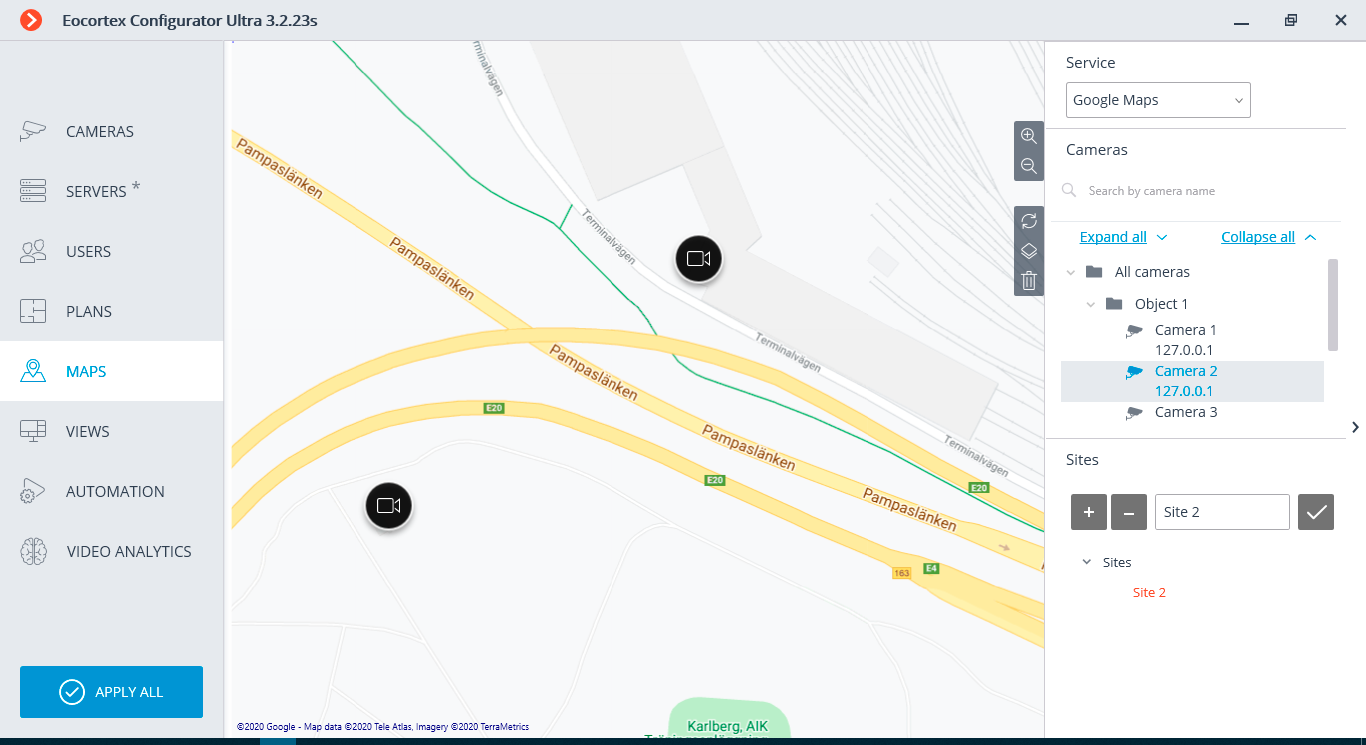
To place cameras on the geographical maps provided by the cartographic services, it is required to go to the  Maps tab in the Eocortex Configurator application.
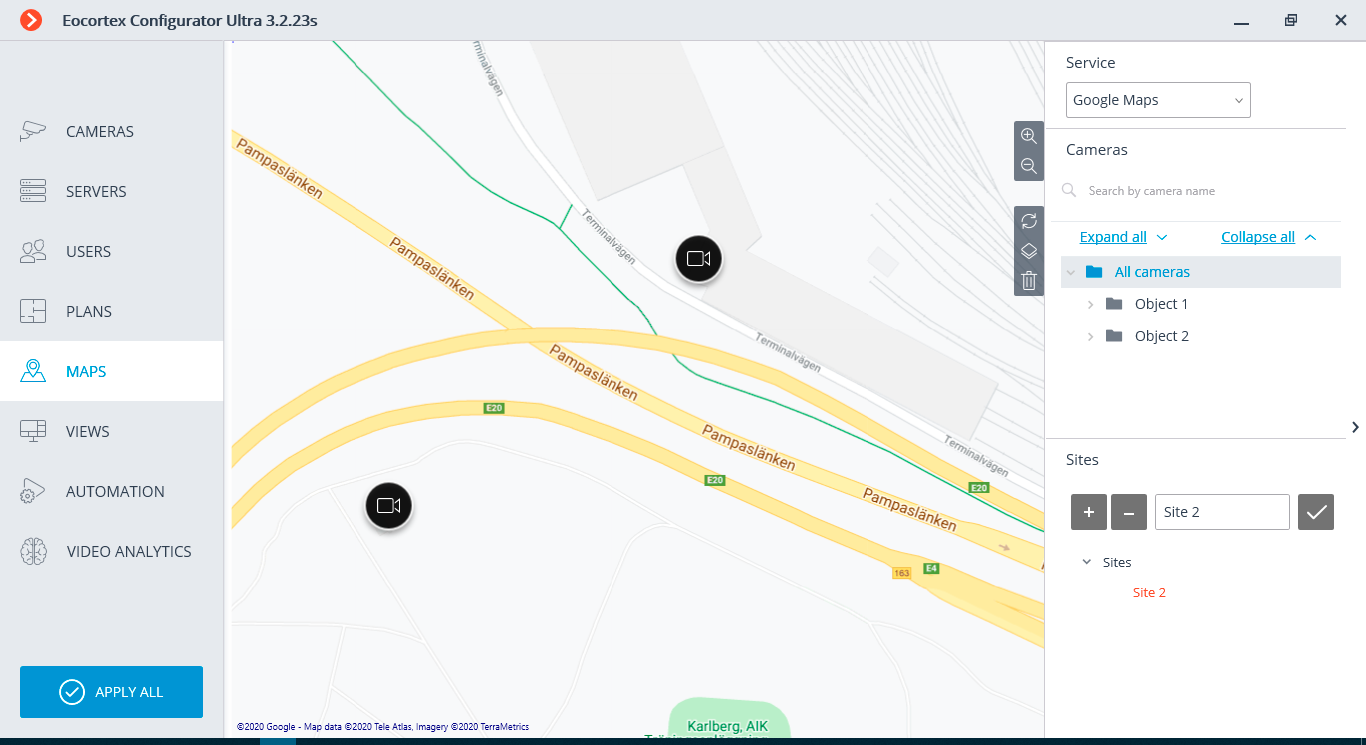
This tab displays a geographical map with the cameras, sensors and relays placed on it.
A bar with the following buttons is placed on the right side of the map:
 Zoom in:
scales up the map.
Zoom in:
scales up the map.
 Zoom out:
scales down the map.
Zoom out:
scales down the map.
 Discard site changes:
returns the current site to its position at the moment of opening the tab or the last application of settings.
Discard site changes:
returns the current site to its position at the moment of opening the tab or the last application of settings.
 Change layer:
modifies the current map layer.
Change layer:
modifies the current map layer.
 Delete all:
deletes all the cameras, sensors and relays added to the map earlier.
Delete all:
deletes all the cameras, sensors and relays added to the map earlier.
On the right side of the window there is a sliding bar with the following elements:
Service: allows to choose a map provider. The current location does not change with the change of the provider.
The maps of the following providers can be used:
- Google Maps. Available layers: Maps; Satellite.
- OpenStreetMap. Available layers: OpenStreetMap; OpenCycleMap; OpenCycleLandscapeMap.
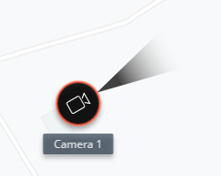
Cameras.
To add a camera to the map, drag it from the list to a required point on the site.
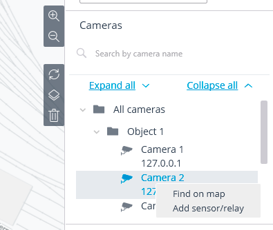
To quickly go to the camera placed on the map, select it in the list and choose the Find on map item in the context menu. The same method works for the sensors and relays located on the map.
The following actions are available when selecting a camera on the map:
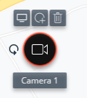
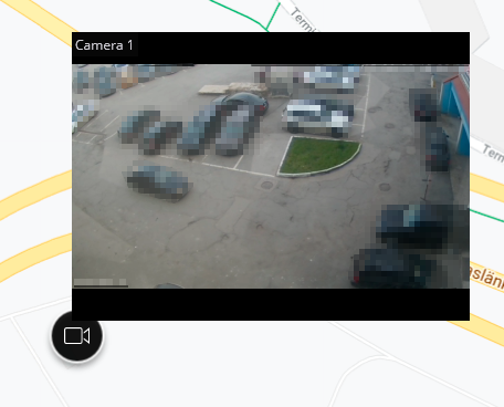
 Viewing:
opens the camera preview window. The preview window also opens when the mouse pointer is hovered over the camera.
Viewing:
opens the camera preview window. The preview window also opens when the mouse pointer is hovered over the camera.
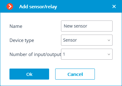
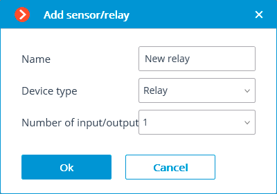
 Add sensor/relay:
adds a sensor or a relay connected to the signal connectors of the camera.
Add sensor/relay:
adds a sensor or a relay connected to the signal connectors of the camera.
The sensors and relays will appear in the list of cameras after being added to the map.

 Delete:
removes a camera from the map.
Delete:
removes a camera from the map.
 Turn:
enables the mode of turning a camera’s icon.
Turn:
enables the mode of turning a camera’s icon.
Sites.
Here it is possible to set up sites that allow users to quickly go to the required locations on the map in the preset scale.