Products
Solutions
Request a call
Get a Free Trial
Industry solutions
Eocortex Deployment Cases
Maps
Maps
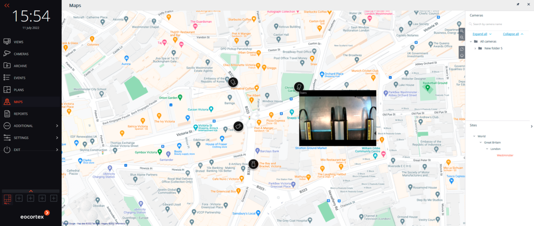
For Eocortex Enterprise and Ultra, graphic maps (GIS maps) of Open Street Map and Google Maps are integrated. This integration increases the convenience of working with the system: by displaying cameras directly on the map of the city, street or individual yard, the operator can quickly understand the situation and respond to it.
How it works
Using GIS maps in Eocortex Client, you can:
- quickly navigate through the locations of the distributed system;
- view live video of the camera in the specific location on the map;
- quickly create views based on cameras of the specific location;
- monitor alarm events on the map;
- receive information from sensors and control relays through the I/O board of the camera.
Your benefits
For each GIS map service, the most suitable view can be selected.
For Open Street Map:
- OpenStreetMap (Standard display of GIS maps)
- OpenCycleMap (Alternative display of GIS map)
- OpenCycleLandscapeMap (Alternative display of GIS maps with landscape elements)
For Google Maps:
- Standard GIS map display
- Hybrid map (Satellite images + roads)
Obtain a cost estimate

✖